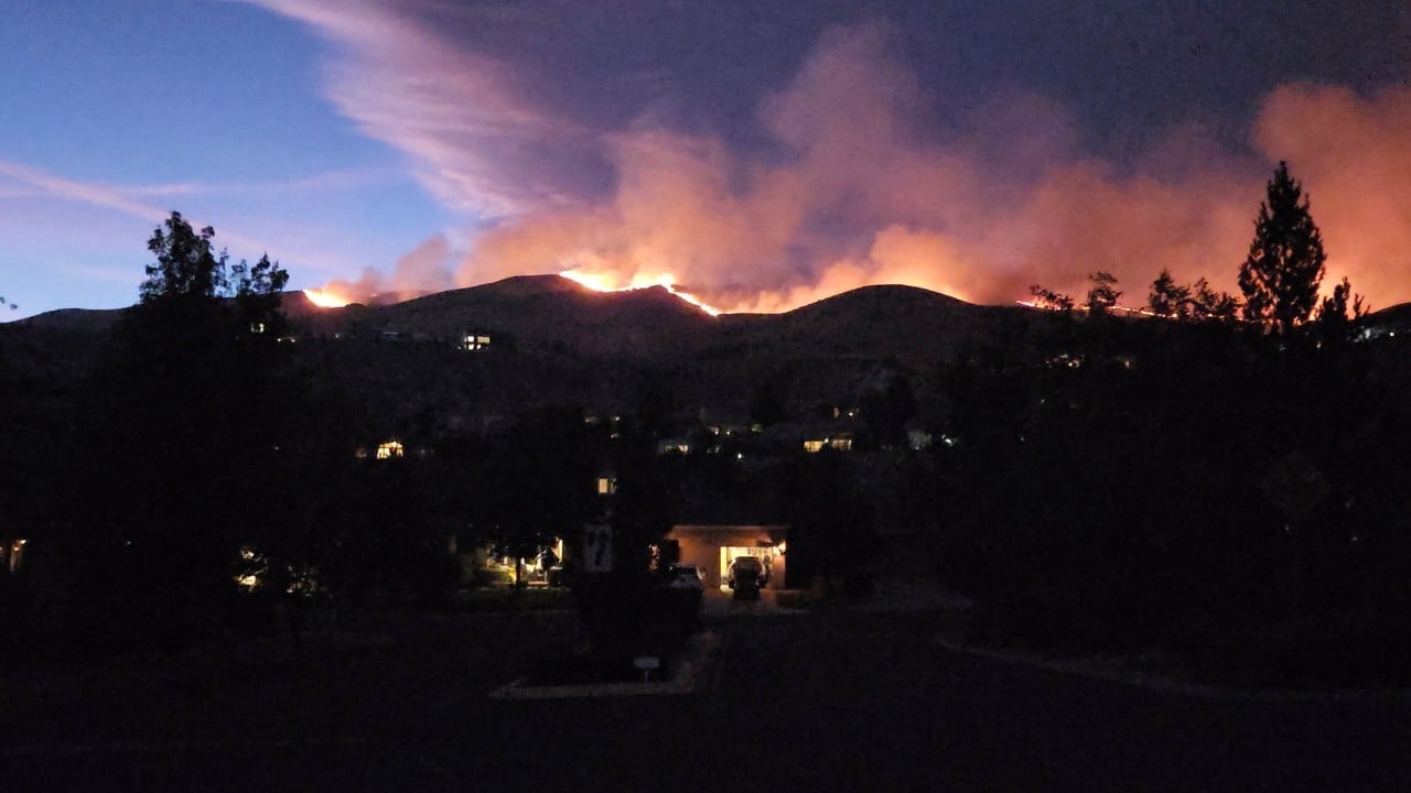
Out-of-control wildfires force mass evacuations with terrifying regularity, yet the mechanisms guiding tens of thousands of citizens away from disaster remain dangerously archaic. When an uncontained fire front sprints across a dry ridgeline under erratic winds, the primary point of failure is rarely the water drop or the firebreak. It is the bottleneck of human panic meeting narrow municipal infrastructure.
Decades of covering emergency responses reveal a recurring institutional blind spot. Authorities issue urgent warnings, but the digital maps citizens rely on lag behind reality, funneling traffic straight into the throat of the beast.
Understanding why these modern displacements spiral out of control requires looking past the wall of flames. We must examine the friction points between civilian panic, municipal alert systems, and the physics of wind-driven fire behavior.
The Anatomy of a Flawed Exit
When thousands of residents receive an abrupt order to pack up their lives and abandon their neighborhoods, the margin for error evaporates instantly. Standard evacuation protocols assume a rational, linear flow of traffic. Reality looks entirely different.
Consider a hypothetical evacuation in a suburban foothill community wedged against national forest land. A sudden wind shift pushes an uncontained fire down a canyon at thirty miles per hour. Sirens wail. Smartphones buzz with emergency alerts. Within minutes, every household on the grid attempts to escape simultaneously via the exact same two-lane arterial roads built decades prior for a fraction of the current population.
Traffic stalls. A single broken-down vehicle or an oversized trailer blocks the lone escape route. The line freezes. Behind the gridlock, the thermal radiation climbs to unbearable levels.
Civilians often rely on third-party consumer tracking applications to monitor fire progression. These platforms frequently lag behind active conditions by critical margins. A family might check their phone, see that a fire front is still two ridges away, and delay their departure. Thirty minutes later, spotting embers leap over a highway, cutting off the exit entirely.
This disconnect between digital data and ground truth claims lives and property every single season. First responders do not just fight the fire; they fight the gridlock. When engines cannot reach the hotspots because civilian vehicles are backed up bumper-to-bumper, the tactical balance tips heavily in favor of the flames.
The Structural Breakdown of County Communication
Municipal authorities face an impossible calculus during fast-moving disasters. Issue an evacuation warning too early, and they risk mass panic, looting liabilities, and economic disruption. Wait until the threat is visually undeniable, and the window for a safe, orderly departure slams shut.
Most county emergency operations centers rely on legacy notification frameworks. These systems require opt-in registrations or sweep landlines that younger demographics no longer use. Geofenced emergency alerts have improved reach, but they lack nuanced directional guidance.
An alert telling ninety thousand people to evacuate immediately without specifying immediate tactical routing causes mass confusion. Drivers turn blindly toward perceived safety, often heading straight into secondary flare-ups.
Furthermore, utility companies preemptively cut power lines to prevent electrical equipment from sparking new ignitions. While necessary, losing grid power instantly takes out local traffic signals, electronic garage doors, and home internet routers. Residents lose their primary source of real-time local news and cannot open motorized gates to escape their driveways.
The cascading infrastructure failure transforms a natural hazard into an operational disaster.
The Human Cost Behind the Statistics
Numbers on a news ticker sanitize the true toll of these events. Thousands displaced translates to thousands of individual decisions made in fractions of a second, often with incomplete information.
Parents racing home from youth sports leagues find their neighborhoods cordoned off by law enforcement. Pets are left behind because emergency shelters historically barred them, forcing desperate owners to choose between personal safety and family animals. Even when temporary shelters open their doors, the psychological shock of losing a lifetime of accumulated possessions in an afternoon leaves scars that linger long after the smoke clears.
The physical environment itself undergoes a permanent alteration. Burned watersheds lose their root structures and soil integrity, setting the stage for devastating mudslides during the next heavy rain season. The disaster does not end when the flames are extinguished. It merely shifts into a long, grueling recovery phase for municipal budgets and displaced families alike.
True resilience demands an honest appraisal of these vulnerabilities. As long as residential growth expands further into high-risk wildfire zones without corresponding infrastructure overhauls, the terrifying scramble down the mountain will remain an annual ritual.
The wind shifts again. The sirens sound. The bottleneck waits.