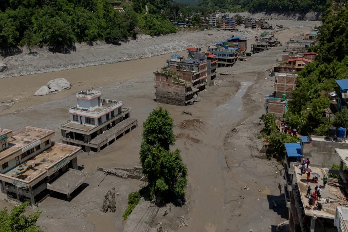
Catastrophes in the Himalayas rarely arrive quietly, yet the wall of water, mud, and ice that tore down the Bhote Koshi and Trishuli river corridors left communities with almost no time to react. When a massive glacial collapse and bedrock failure high near the Nepal-China border triggered a sudden flash flood, automated monitoring stations went silent before transmitting signals. Hundreds lost their lives, and thousands more went missing, raising a painful question. Could this destruction have been mitigated, or are mountain communities entirely at the mercy of unpredictable terrain?
The Anatomy of a Himalayan Flash Flood
The disaster wasn't born from ordinary monsoon rains alone. High-resolution satellite analysis confirmed that a massive section of rock and ice broke away near Langtang Lirung. The impact generated tremors powerful enough to be mistaken initially for a magnitude 5.2 earthquake. Within minutes, pulverized ice and debris transformed into a destructive slurry, racing down steep valleys and swelling rivers by nearly thirty feet in less than half an hour.
When water moves that fast through narrow mountain gorges, conventional early warning infrastructure faces severe physical limits. Sensors stationed along upper river basins were smashed or swept away before automated text alerts could reach downstream villages in Rasuwa. Whistles and shouts from alert residents became the only warning system that worked in real-time.
Where Planning Met Hard Reality
Disaster management experts often point to long-term risk assessments and pre-monsoon advisories, but high-altitude hazards operate on a different timeline. While regional hydrologists track melting permafrost and shifting glacial lakes for months, pinpointing the exact hour a mountainside will fracture remains scientifically impossible.
Blaming a lack of preparation oversimplifies a complex crisis. Cross-border communication gaps between upstream regions and downstream settlements complicate rapid responses. When automated gauges fail instantly under the weight of a debris flow, emergency agencies lose their vital window of operation. Hundreds of mobile alerts sent downstream later saved lives in areas like Nuwakot, but upper basin regions bore the full brunt of the initial surge without digital protection.
Rethinking Mountain Safety Measures
Protecting vulnerable mountain populations requires moving past basic river gauges that wash away during the first minute of an impact. Communities need robust, satellite-linked sensors positioned far above riverbeds, alongside decentralized local response drills that don't rely solely on mobile networks failing during a crisis.
As global temperatures continue to destabilize high-altitude permafrost, these sudden glacial events will test regional infrastructure repeatedly. Understanding the limits of current technology means investing heavily in resilient cross-border data-sharing networks and giving local residents the structural tools to survive when every single second counts.