Environmental conservation sounds peaceful enough. But in the Aegean and Eastern Mediterranean, drawing lines around fish and coral reefs is basically a proxy war for sovereign control.
When Ankara formalized two new national marine parks through presidential decrees signed by President Recep Tayyip Erdoğan, Athens didn't see an eco-friendly initiative. They saw a deliberate landgrab masked as environmentalism. This latest flare-up proves that decades of unresolved maritime disputes can easily reignite over something as seemingly mundane as marine spatial planning.
How Environmental Zones Became Geopolitical Weapons
You might wonder how putting restrictions on fishing and anchoring turns into a major international crisis. The answer comes down to geography and legal definitions under the Law of the Sea.
Greece moved first by announcing marine protected areas in the Ionian and Aegean seas. Athens insists those zones stay strictly within recognized Greek territorial waters. Turkey viewed that move as a unilateral attempt to lock in favorable maritime boundaries. Ankara’s response? Mirror the strategy right back, but with a twist.
Turkey’s newly designated zones—one in the northeastern Aegean near Imbros, Tenedos, Lemnos, and Samothrace, and another in the eastern Mediterranean stretching toward Kastellorizo—extend well past traditional Turkish territorial waters.
Athens reacted instantly. The Greek Foreign Ministry labeled the Turkish decrees entirely illegal, arguing that a state cannot unilaterally establish protected areas in international waters or over another country's continental shelf.
The Real Agenda Behind the Maps
Let's be honest about what is actually happening here. Neither government is losing sleep over local habitat fragmentation.
Turkey has long maintained that major Greek islands close to its coast shouldn't generate expansive continental shelves or exclusive economic zones. By drawing administrative boundaries around these disputed sectors, Ankara asserts the right to exercise sovereign authority through scientific and technical management.
It is a clever legal maneuver. Designating a park doesn't instantly redraw international borders on paper, but it creates administrative facts on the ground. It forces commercial vessels, researchers, and neighboring nations to deal with Turkish permits and regulations in areas that Greece considers contested or explicitly its own.
What This Means for the Fragile Status Quo
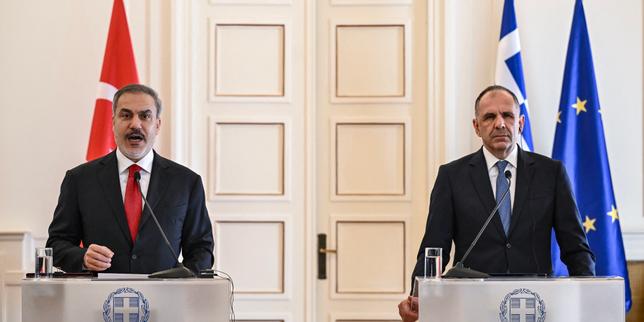
For a brief window, bilateral relations between the two NATO neighbors felt surprisingly calm. Leaders on both sides had signed the Athens Declaration aiming for good neighborly relations and open communication channels.
That diplomatic goodwill is now cracking under the pressure of overlapping maps.
When environmental policy collides with long-standing security anxieties, compromise becomes nearly impossible. Greece sees the Turkish decrees as an aggressive push to legitimize the broader "Blue Homeland" doctrine, which claims vast swaths of the Aegean. Meanwhile, Turkish officials argue they are simply protecting their maritime jurisdiction against Greek overreach.
The immediate danger isn't an accidental environmental disaster. The real risk is physical friction on the water. If research vessels or commercial operators seek clearance from Ankara to work in these disputed zones, Greek authorities will feel compelled to intervene.
Keep an eye on how maritime traffic and NAVTEX navigational telex alerts are handled in the coming weeks. If either side attempts to enforce these administrative boundaries with coast guard patrols, a diplomatic paper war could quickly transform into an operational confrontation.